Alive and Well
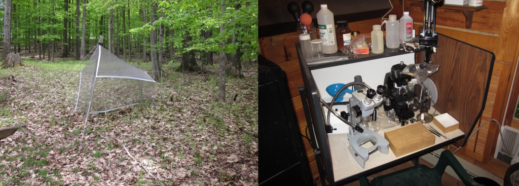
April 20, 2022It is hard to believe that it has been seven years since I posted anything here. That seven years has been a roller-coaster if anything ever was. At my job, I got promoted; and at home, a varity of changes--including some health issues--made it very difficult to complete any work. However, I did manage to accomplish something--namely, I was able to purchase and set up everything I will ever possibly need to continue working on robber flies. Someone once said that when you are old you have plenty of money and no time; whereas, when you are young, the opposite is true. I can vouch for that. During that seven years I bought everything I thought I might ever possibly want, from a phase-contrast microscope to several microphotography setups, as a conscious preparation for when I will have more time to work on asilids when I retire, and, of course, will also have a lot less less discresionary income than at present. My purpose in this short post is to let everyone know that I have resumed working both on this blog and the associated papers, in other words, what I am supposed to be using all that equipment for, and am alive and fairly well. I am 70 years old now. Hopefully I will manage to complete my papers relatively quickly and then work on asilids as a hobby for another ten years. I plant to retire from work in two years, when I am 72.
I should be attending the North American Dipterists Society (NADS) field meeting in New Jersey June 13-17.
On a technical note, I switched the website server from a local, private company to Amazon Web Services. For me, this was extremely cheap--AWS hosting is only about one dollar a month. For you as my audience, it means that you can now bookmark individual pages within the domain, with the bookmark working later to direct you to that exact page, instead of to the index page for the whole site. Not having this ability was always a big aggrevation for me. BTW, I cannot claim to have figured out how to implement it on my own--my son, who is a programmer and software engineer, did it for me.
A correlated technical change is that I switched from using a typical FTP client (in my case Total Commander) to upload material to a free program called CrossFTP. In spite of the name this is a "Cloud Storage Client." That isn't real FTP, but it works similarly, and such a client is required to access AWS. Again, my son set this up.
One other thing I finally got working is using map making software, namely QGIS. This is free. I have it installed on an XP Pro system, a Windows 7 system, and on my new Macbook Pro. It works beautifully on all three. I had to do some hacking to get it installed on the XP system. I will be including many maps made with this software here.
Believe it or not I do almost everything on this last--what many people would consider to be ancient--Dell XPS desktop, hailing from around 2006 or so. For most things, this works much, much better than you might at first think. For example, the QGIS I mentioned above works as fast on the XPS system with two 3.6 GHz cores, as it does on my Macbook Pro M1, with 10, something like 5GHz cores. I was able to max out everything, so if I had purchased it at the time it would have cost about 30 grand. The only real drawback it that the available browsers can't handle some webpages. They do work perfectly for other video, including almost everything on YouTube. I'm writing and uploading this blog post on it today
At the risk of rambling, I should say that QGIS or any other fancy software really isn't necessary to make distribution maps. The old method of rubbing off stick-on dots on paper US county maps or parts of them, and then scanning these, works as well as anything (actually, now this means using the original Microsoft Paint, a map scan, and electronic dots). That requires zero set up and is essentially free. If there is a drawback it is that it can't handle latitude and longitude. Very little of the historical material has coordinates anyway. The only reason I set up QGIS is that I used to work with ArcMap as part of my job, and wanted to do something similar at home. It is easy to get too wrapped up in technology.
Last, I should apologize for the the general disrepair of the website, apart from what needs to completed. There are many broken links that need to be fixed, especially those connecting to the Museum of Comparative Zoology for types. The MCZ seems to change the address for those pages frequently. I also need to revise the introduction to recognize the switch away from the old subfamily classification to that of a series of tribes. I'll post here when I make a significant change.
 Digg
Digg
 Facebook
 StumbleUpon
 LinkedIn
 Twitter
 Email
Email